
Republished by Blog Post Promoter
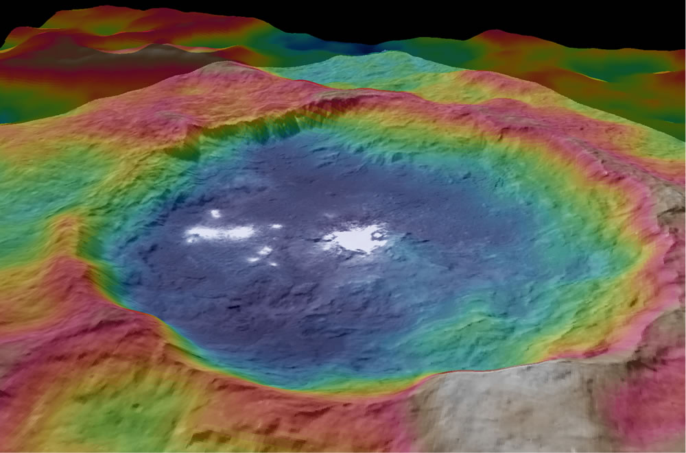 The most recent composite image released by NASA’s is a color-coded topographic map of Occator crater on Ceres. The photo is extremely low-resolution, of course, so no details of the “city” or “base” can be clearly seen. However, the image does provide a sense of depth and proportion of the “lights” compared to the size and topography of the crater. The blue is the lowest elevation, and brown is the highest. The crater is approximately 56 miles (90 kilometers wide). Proportionately, the “lights” could extend roughly 20 miles (32 kilometers) in length.